counts, classifies and labels vehicles in real-time
v3 Trafficview ™
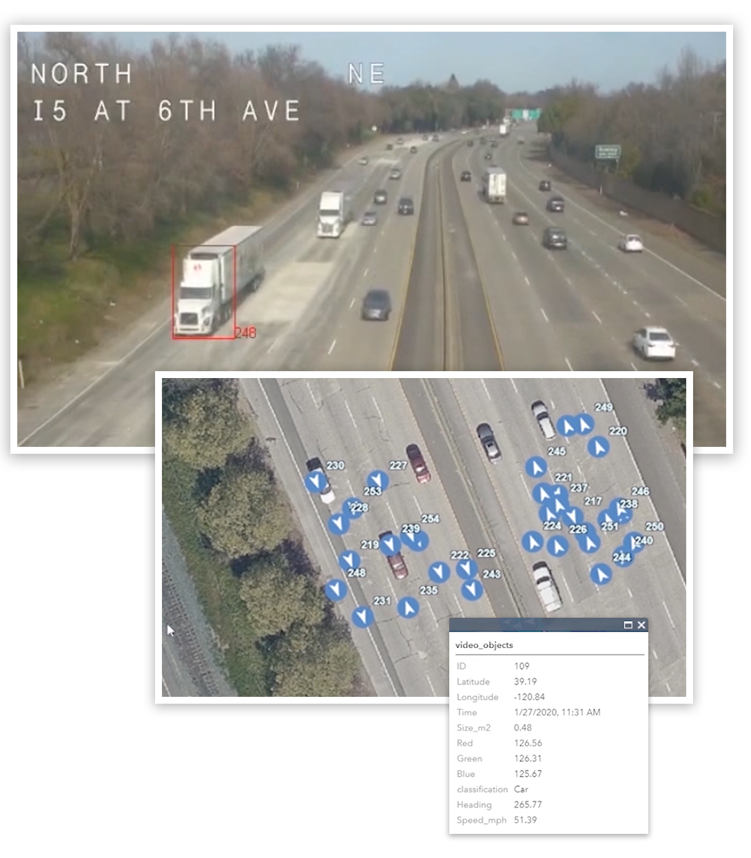
Trafficview™ is a subset of v3 Tools that is designed to use streaming video or CCTV to count cars, trains and people and send the extracted data to ArcGIS Pro in real-time. Trafficview is a practical tool for reading roadside streaming camera feeds to detect, track, count, measure, classify, geo-locate and database the extracted vehicle information while at the same time sending a real-time TCP and or JSON data socket to ArcGIS Pro for visualization.
Turns Streaming Video Into Instant Geographic Information Systems (GIS) Data
v3 Trafficview can read web, SD and HD streaming camera feeds. It is a simple way for traffic managers to turn every streaming camera into a real-time data feed.
Fully automated analysis of Full Motion Video (FMV) and other sensor imagery data
Includes streaming video, thermal IR, WAMI and satellite imagery
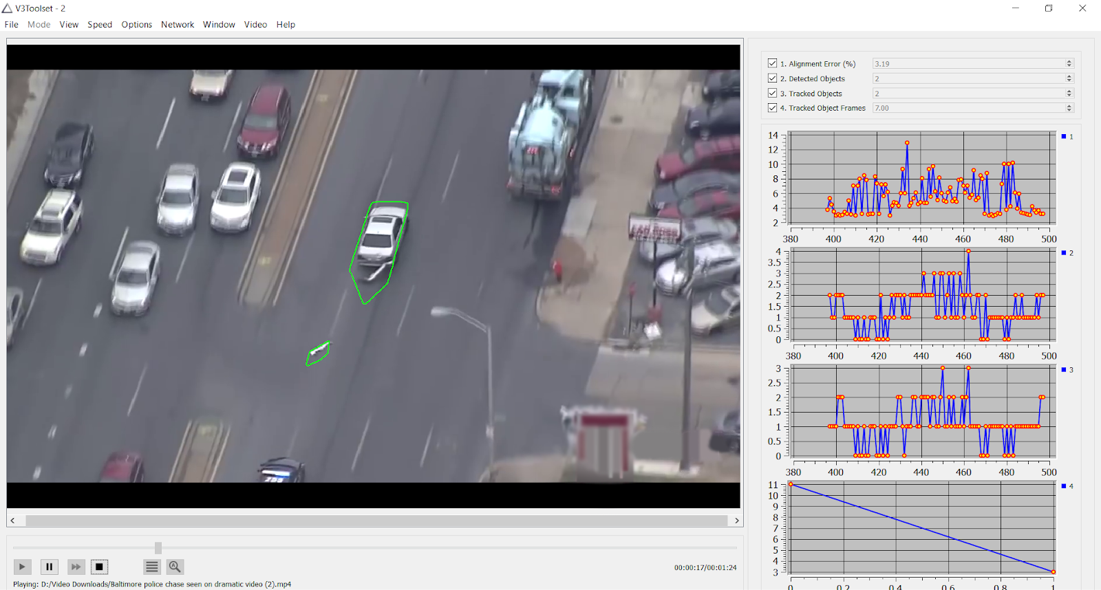
Automatically detects and tracks objects in each frame of video, counts, geo-locates, and measures each object’s properties, and writes the data from each frame to a database
Database information can be output and visualized in specific modes (tracking, shape, segmented and image chips)
Automatically generates large training datasets in many formats, including bounding boxes, semantic segmentation shape files or polygons, and pixel masks suitable for use by AI/ML applications
Detailed object properties (multi-dimensional feature space) are provided for Third Wave AI processing
v3 Tools detects, tracks, classifies, geo-locates and databases object information extracted from, among others, streaming video. All in real-time and without requiring a software training database.